
Das Boot Berme// YSOA Urban Studio Midterm Proposal
(see Final proposal here)
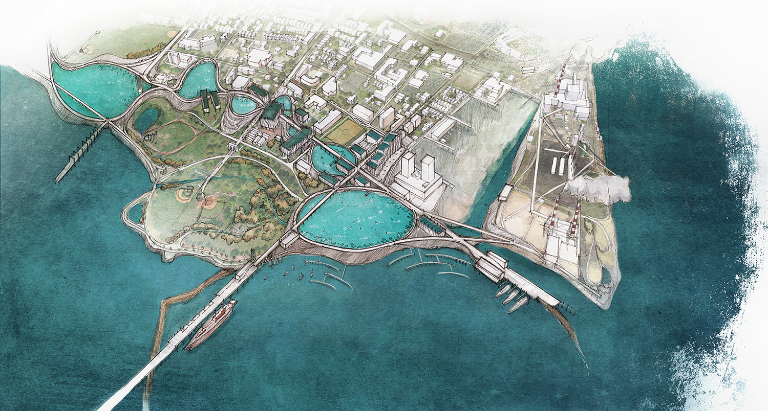
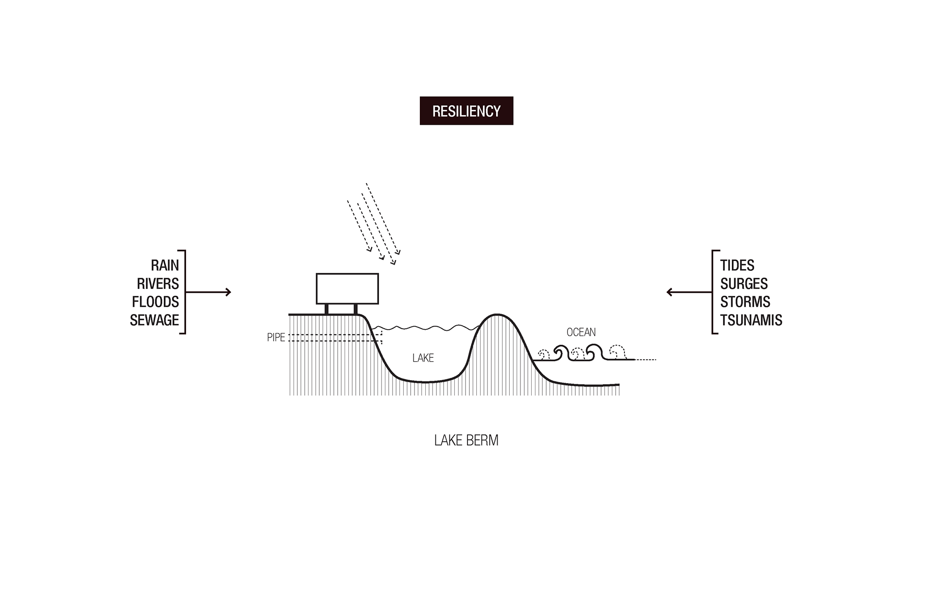
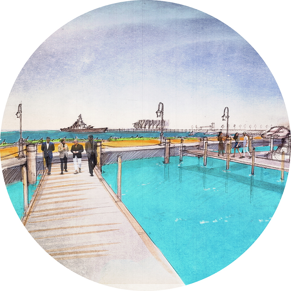
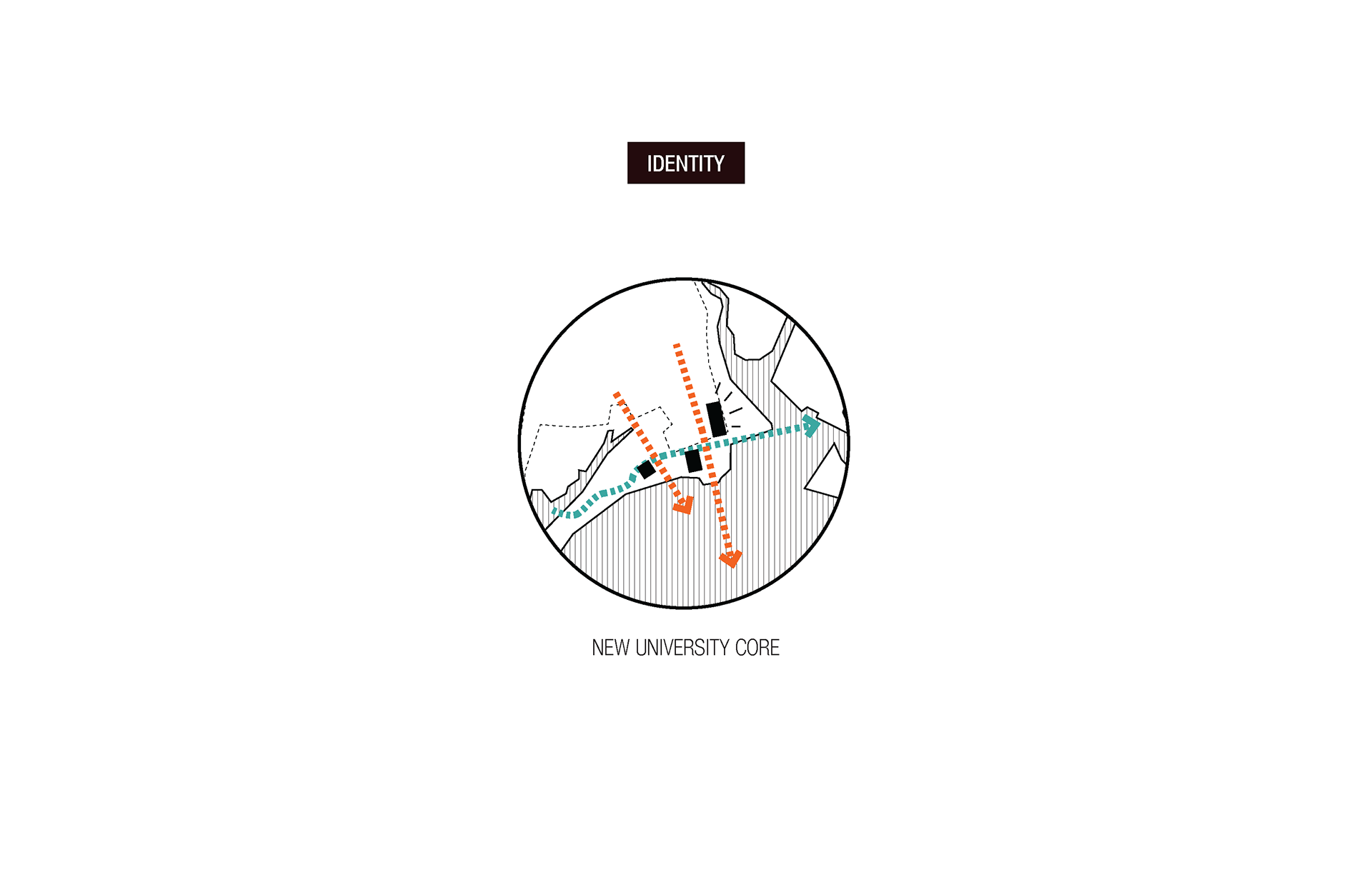
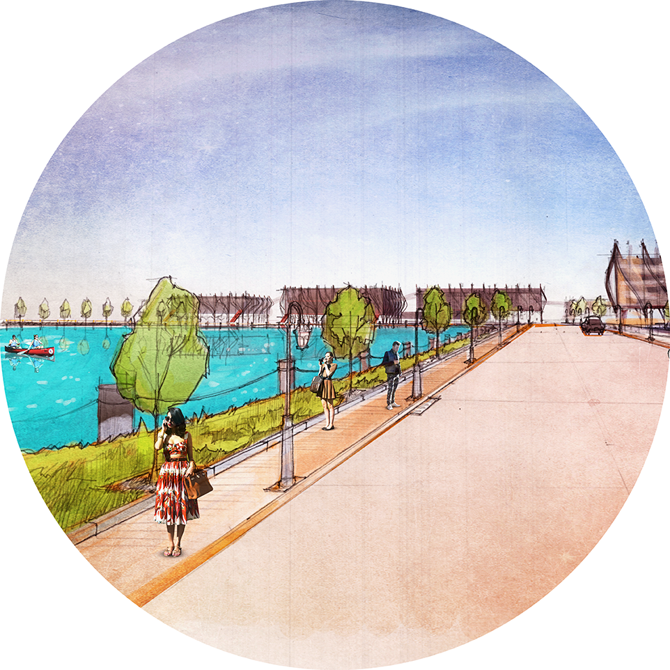
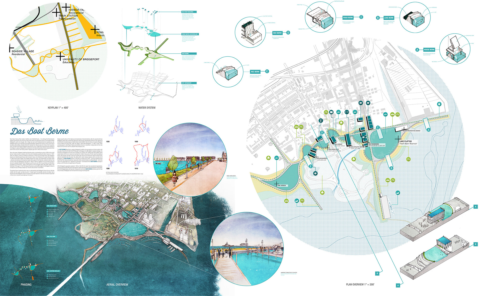
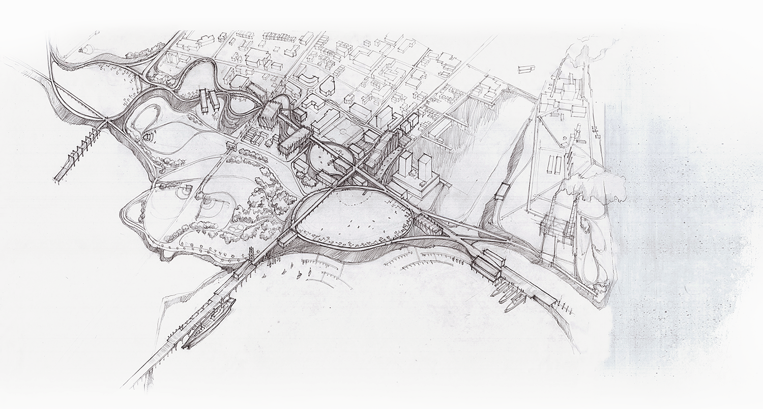
The BOOT BERME (Boat Berm) reclaims Bridgeport’s tradition of encouraging an intimate relation with the water. Part of the STUDIO PLATTYPUS plan for Bridgeport, the BB adopts a highland strategy: the University of Bridgeport will build future buildings as a system with rooftop water filter abilities along raised roads which in turn wrap nine new lakes for a total of sixty acres of fresh water. By creating a barrier high enough (20 feet) to fend off hundred year storms the investment meets the South End’s need for protection from the ocean. By adding storm water storage capacity which can serve all of Bridgeport, the BOOT BERME delivers a vital piece of infrastructure which - carefully wrapped around South Sea Park and punctuated by major piers which extend Iranistan and Broad Street - will at the same time expand Barnum’s “approach to the beach.” Like Seaside Park, BOOT BERME develops in phases, with full build out happening over fifty years.
While Bridgeport’s population peaked in 1950 at 158,709, the region has exceeded all expectations, growing to almost 900,000 citizens (far beyond a 1963 regional plan’s predicted population of 500,000). It is time Bridgeport play a driving role in that growth once more, BOOT BERME provides a plan for how the University of Bridgeport and the South End will plug into that growth.
(text by Nicolas Kemper)
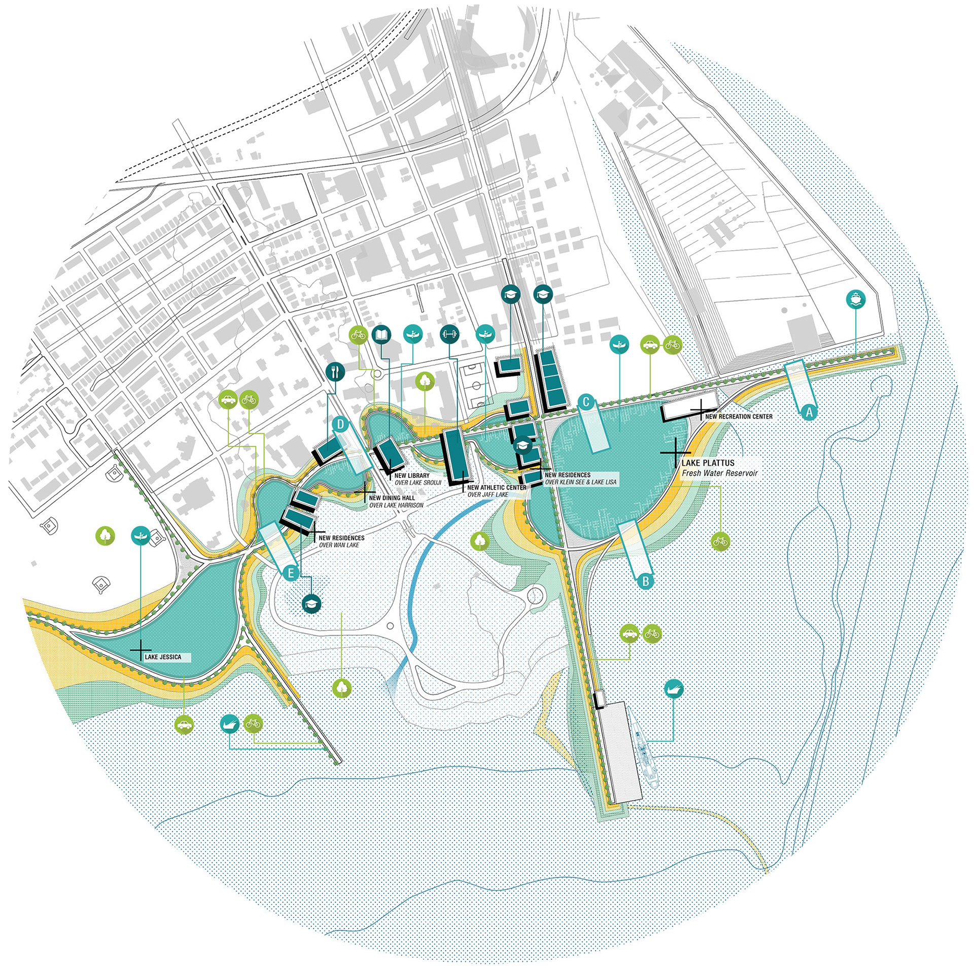
Plan for the Boot Berme comprising the new spine of the Sapphire Lakes, new campus buildings as well as two new extensions of Bridgeport infrastructure -- Broad St & Linden Ave.
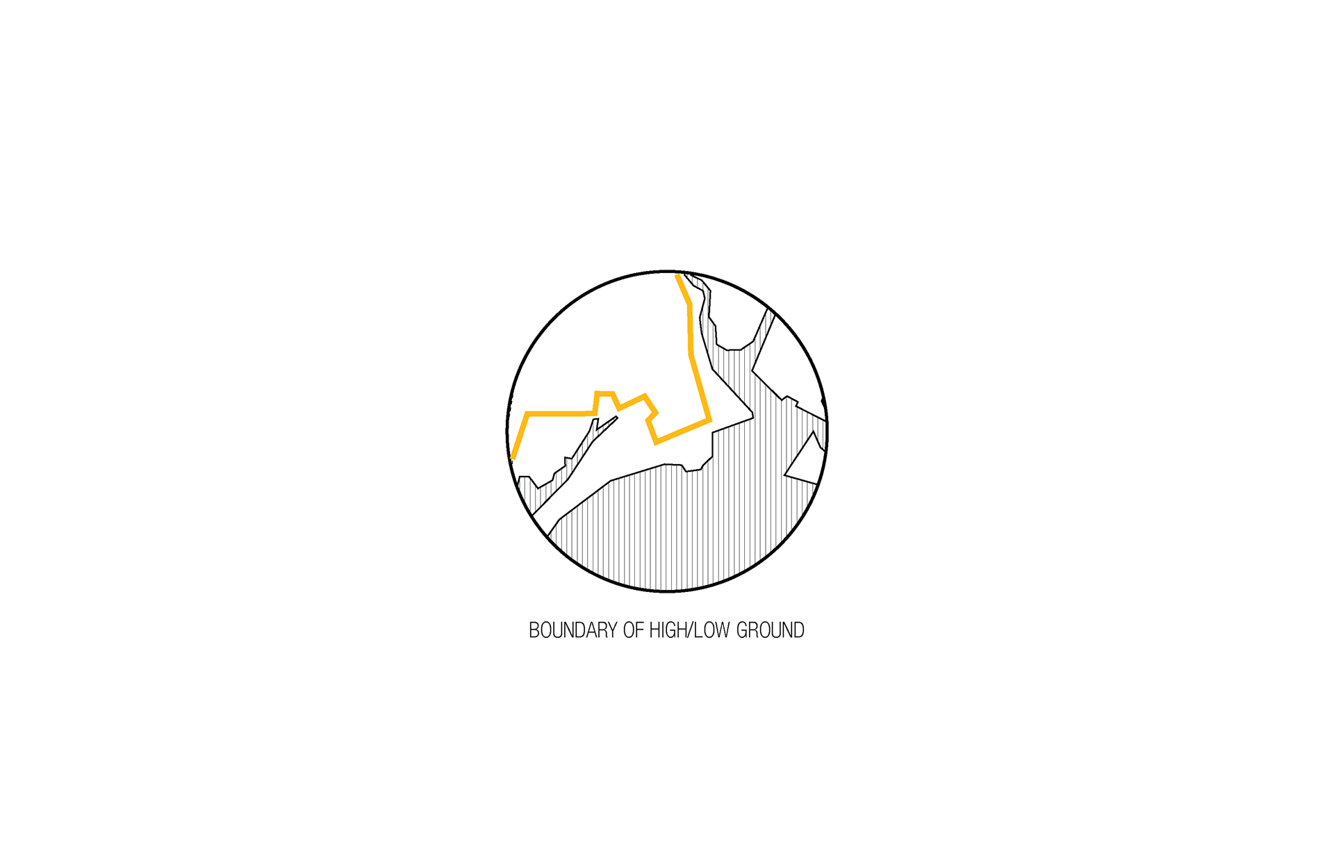
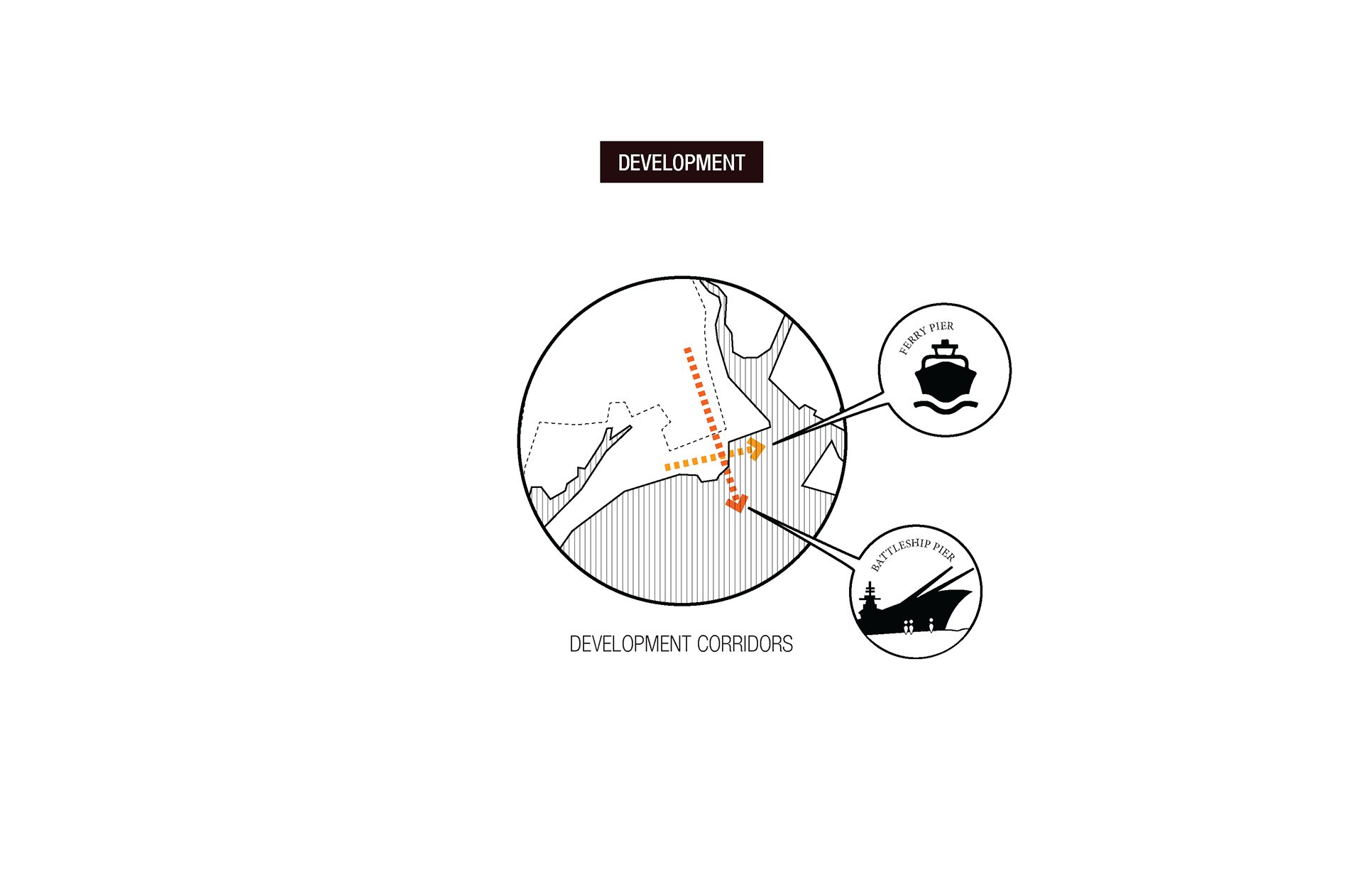
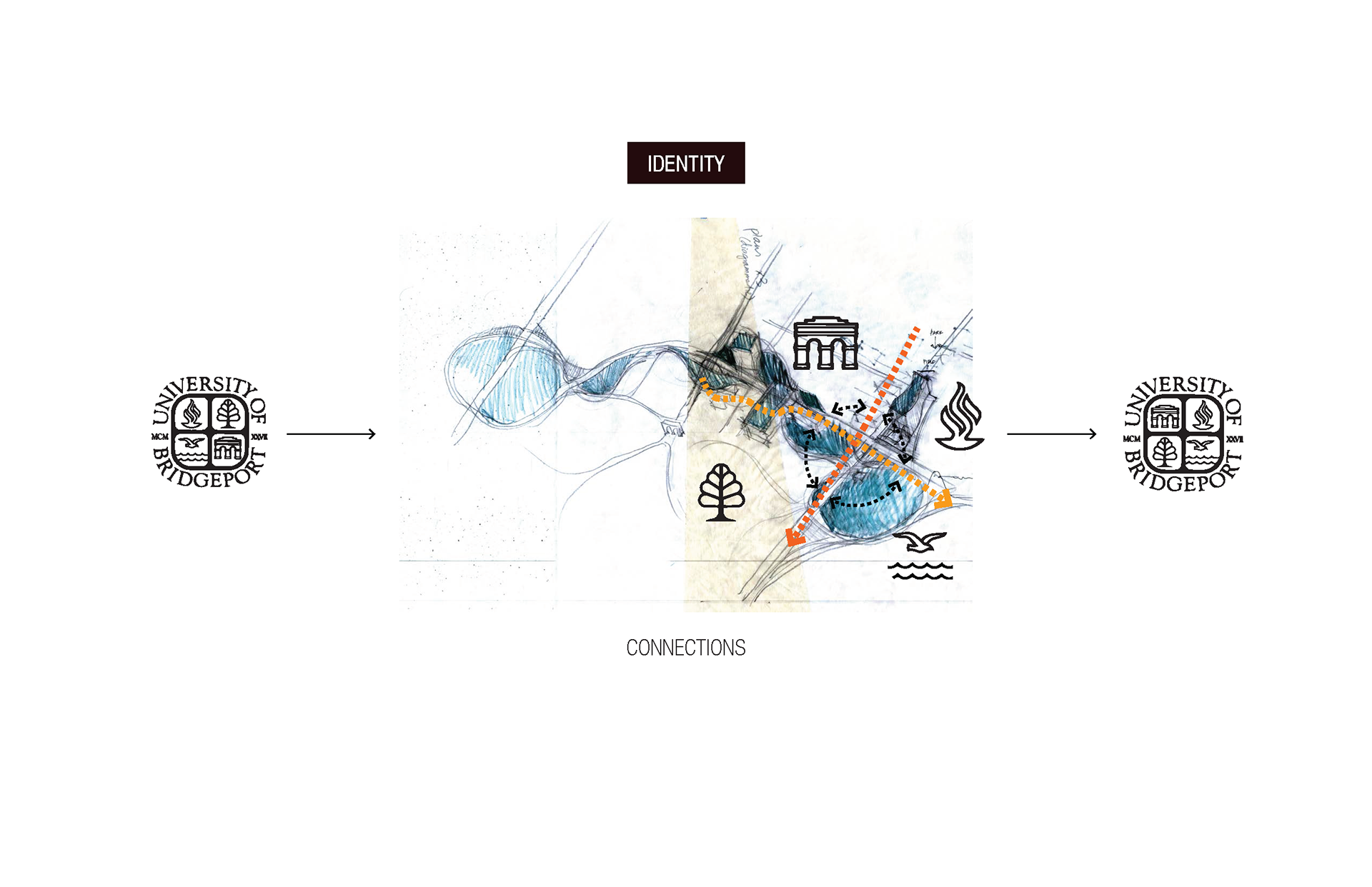
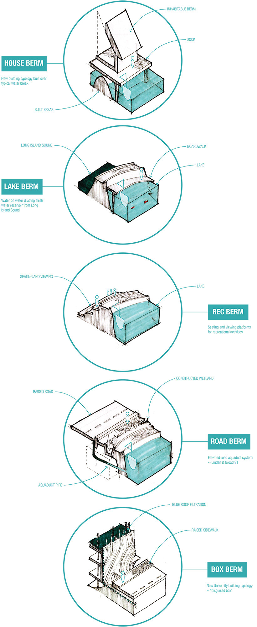
Strategies for the Boot Berme through close-up details of specific conditions as indicated on the plan
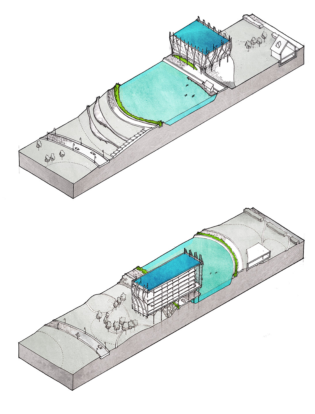
Two sections cutting through major aspects of the reservoir/new building conditions. One looks at the building to the north of the lake, the other locates the building to the south of the lake, bridging Seaside Park and the campus.
New Haven County, New London, Hartford, even Fairfield County - it is striking that Connecticut’s largest city should be one of its only major cities without an eponymous county. The overlook reflects Bridgeport’s youth and struggle: still a village not even worth looting during the revolutionary war, Bridgeport grew up as a borough of its neighbor Stratford, expelled from its city in 1821 at the hest of its jealous elder sibling: whereas Stratford it retained five miles of coast, ten miles of the Housatonic River, and half of the harbor, Bridgeport was left with a mere 1,000 feet of coast and three quarters of the bridges to upkeep. Bridgeporters complained to the General Assembly of being “deprived of their lawful name as town and having another imposed upon them without their consent.”
Not a city to pout, Bridgeport replied with decisive action, incorporating at a city in 1836 so they could borrow money to build a railroad, which they did immediately, passing the bond measure in 1837. After the railroad, a series of ambitious investments in their city and infrastructure saw Bridgeport become an industrial powerhouse and immigrant mecca: not endowed with a great natural harbor, in 1888 harbormaster Captain John McNeil widened the harbor up to Black Rock and Cedar Creek , allowing manufacturers to bring their freight within yards of their factories, instead of carting it two or three miles from Bridgeport’s East Side. In 1863, PT Barnum lobbied the city and led a group of donors to establish Seaside Park. Starting at just 35 acres, by 1915 city purchases and donations increased it by 200 acres - today at 340 acres it is one of largest ocean side public parks in the Northeast. Then again in 1947 the Corps of Engineers used landfill dredge from Bridgeport Harbor to increase the size of Pleasure Beach by 16 acres and connect it to Stratford.
Throughout these investments there was an understanding that Bridgeport thrives from an intimate relation with the water: as Barnum put it, “it dwelt upon the absurdity, almost criminality, that a beautiful city like Bridgeport, lying on the shore of a broad expanse of salt water, should so cage itself in that not an inhabitant could approach the beach.”
Swept up by the allure of the highway and vicissitudes of industrial decline, after the second world war Bridgeport made major investments against the spirit of that understanding. With the 1957 opening of the United Illuminating Company’s Harbor Station and the $464 million Connecticut Turnpike, Bridgeport firmly sundered its South Side. Under the slogan, “Brand New Bridgeport,” in 1962 a major urban renewal program under Mayor Tedesco demolished 52 acres in downtown, trading fabric for the new Route 25-8 connector and the Lafayette Plaza shopping mall.
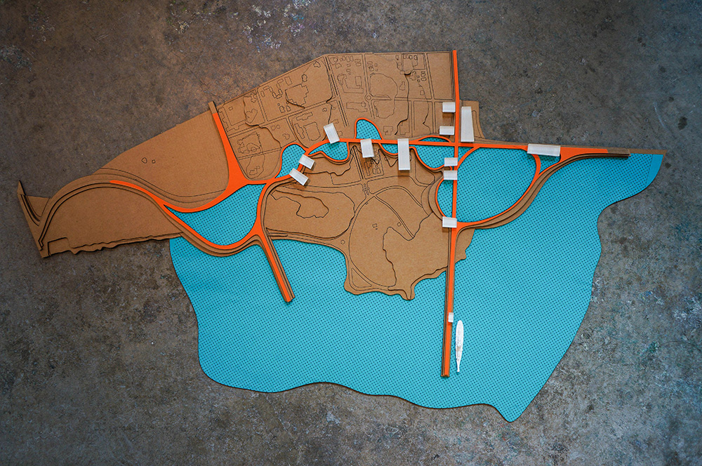
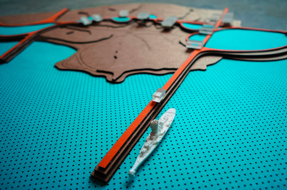
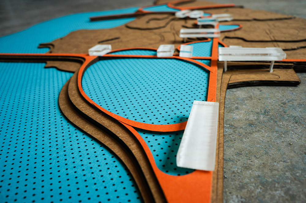
conceptual overview model
Final board layout for midterm presentation
original linework scan of aerial